![]()
I was all set to tell you about the geology and geography of Southern Ohio and how it related to that of West Virginia, and then this naked guy materialized in a golf cart.
But really, geography and geology are very important things and should preempt him for the moment, if for no reasons other than size and seniority. You see my point, don’t you?
The small roads that we’re traveling on in Southern Ohio are every bit as well-paved as the small-road route we took through West Virginia. So far, it’s mostly the larger highways that seem to be in desperate shape in Ohio.
As far as topography goes, the Hocking Hills area of the state has contours reminiscent of West Virginia, but with fewer ridges and softer stone.
Apparently the formation of the State went something like this: There was a huge and shallow inland ocean covering the midsection of what we now call the United States. Over the millennia lots of little mollusks died and otherwise laid down limestone deposits along the shores. This was the foundation for what we presently think of as West Virginia. Eventually the middle of Pennsylvania rose up, mountains were formed there and to the west and they immediately began to erode. The sand washed out of these new mountains and was flushed westward where it formed sandstone deposits in Southern Ohio. After a bit longer, those sandstone deposits also folded up, perhaps after crashing into West Virginia which had been doing a bit of uplifting on its’ own.
One result of the Ohio uprising is the Hocking Hills area with surprising sandstone cliffs, cool trails on the valley floor, and delightful waterfalls under a canopy of hardwoods. Wonderful geology, pretty good hiking, beautiful forests and no shortage of humidity.
We spent much of the day walking, lazing about and grazing from the cooler and picnic basket, and leisurely driving the small state and county roads that meander west in the direction of Cincinnati (where we’re headed for chili.)
We stopped to look at 6 or 8 covered bridges, including one that was sheltering a 76 year old farmer who had been bringing in the hay before a sudden downpour. He thought there was a good chance he was going to lose that cutting of hay. I suppose that he was right.
We also hiked the Cantwell Cliffs for a couple of hours and later walked the area of the Selp Burial Mound near Bainbridge, Ohio. It was getting late but I thought we could make a good run at getting to the Serpent Mound near Peebles before calling it a day and we set off on the most direct route, which just happened to be a Scenic Byway.
It was nearly 4:30 PM when we arrived at the Serpent Mound. So we decided to begin the following day with a close look at the Mound, rather than rush through before finding a campsite for the night.
The Ranger staffing the Ohio Historical Society’s museum at the Serpent Mound advised us that he personally knew nothing of the camping possibilities close by but he let us look at his only copy of a listing of campgrounds provided by the Adams County Chamber of Commerce. I called the closest one: Cedar Trails Campground.
“Sure” the fellow said, “we have lots of room, fifteen dollars a night” and he gave me directions.
We wound back off the scenic byway, we crossed bridges, we turned left and then right at forks, and watching as the road first narrowed through fields of corn and then became gravel. I’d have thought we were lost, except that his directions were spot on.
Just at the promised turning a single sign appeared: “Cedar Trails Campground.” And so we turned in. We were far enough from the “highway” that I was pretty sure we would have a quiet night.
We parked near the small wood-sided building beneath the “Office” sign and I walked in, but no one was in the single room. So I walked back out and was standing there beside Denise and looking about when a naked guy drove up in a green golf cart. He seemed to be expecting us.
He was uniformly tan, so I stifled my first impulse–to point out that he didn’t seem to be wearing any clothes, and instead I inquired if we’d inadvertently stumbled into a nudist camp. Of course, that’s exactly what we’d done.
For his part, Ken–for that was the naked guy’s name–had neglected to mention that fact when I called. The Cedar Trails Campground is pretty far off the beaten track and I suppose that the folks who materialize there generally know what’s in store before they arrive.
Anyway, business was slow on a Tuesday, with just three or four couples on the 50 acre site so he graciously welcomed us to pitch our tent. In truth it looked to be a magnificent campground facility, and since it was getting late, and since we were already there and, what-the-hell–why not? And so we stayed.
We passed what was an uneventful and quiet night, if you discount the torrential downpour during dinner, and woke to a damp but comfortable dawn. We proceeded to breakfast and then break camp and hang a few things to dry before returning to the Serpent Mound for some misty early morning contemplation about the origins of culture and the significance of various human symbols.
Returning to Cedar Trails, we bade Ken and Fred and JoAnne, the owners and builders of the Cedar Trails Campground, farewell and we set off to Cincinnati in search of the Underground Railroad Museum, American Sign Museum and the Skyline Chili restaurant. About which, more, later.
But before I let you go, guess what?
I get that nekked business. It reminds me of skinny dipping in Oregon and hot springs in the woods. It really is quite comfortable to walk about in the altogether in the great outdoors in the company of others. Try it sometime, even if by accident.
Bill
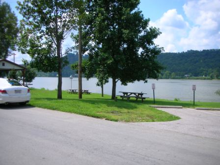
Lunch in Ripley, Ohio, an Abolitionist hotbed. Additional photos filed in the “Road Trip” page.
Tags: Retire, Retirement, Road Trip